In a near repeat of a similar event two years ago, heavy thunderstorms pounded the Toledo area again and again last night and this morning. The weather station recorded a storm total of 4.10" of rain which is less rain over a longer period than the 2006 storm, but for some reason the basement flooding situation here has been far worse. I'm not sure if it's because of already saturated ground or what, but I've been fighting a torrent of water flowing into my sump pit for over 12 hours now. It's coming in faster than I've ever seen, and it's coming in with such force that it's impacting the pump itself, not allowing it to shut off. I have wedged some pieces of 2x4 in the pit to divert the flow away from the pump, allowing it to shut off for around 3 seconds per cycle. Not ideal by any stretch but better than the pump continuously running.
I haven't been out yet today but I imagine others in my addition and elsewhere are suffering more than I am. I have a top-of-the-line pump and if it can't keep up, I'd imagine my neighbors with the default pump are flooding. I do have to go out this afternoon, and it's definitely Jeep weather. I'm not sure of the road flooding situation, but I will try to get as much info as I can before I leave.
Thursday, July 03, 2008
Thursday, June 26, 2008
New Weather Website
My weather website that is being run in conjunction with Lucas County Choppers, LCC Weather Net, is live in a pre-launch form at wx.lcchoppers.com. This is certainly not the final version of this site; I hope to add a lot more functionality to it as I become more capable in writing PHP scripts and adapting them to the site. However, this draft version is functional, which is whats important.
I had some serious trouble with Weather Display, the shareware weather software I was testing. I had a power outage during a heavy rainfall when I was at work, and I wasn't able to get the data upload restored until around 5 hours later. When I restarted the program, instead of downloading the actual rainfall data it averaged the rainfall rates from when the power went out down to zero over the five hour span, giving me a total of around 1" more than actual. It screwed up both my Weather Display and Weather Underground data, which didn't make me very happy. So I've abandoned Weather Display (which would have cost $73 to register) and am now planning on using Virtual Weather Station, which will cost a tiny bit more to register but is more stable.
I had some serious trouble with Weather Display, the shareware weather software I was testing. I had a power outage during a heavy rainfall when I was at work, and I wasn't able to get the data upload restored until around 5 hours later. When I restarted the program, instead of downloading the actual rainfall data it averaged the rainfall rates from when the power went out down to zero over the five hour span, giving me a total of around 1" more than actual. It screwed up both my Weather Display and Weather Underground data, which didn't make me very happy. So I've abandoned Weather Display (which would have cost $73 to register) and am now planning on using Virtual Weather Station, which will cost a tiny bit more to register but is more stable.
Wednesday, June 11, 2008
Updates on Monday's Weather
The National Weather Service in Northern Indiana has completed a few important surveys of the severe weather event that struck the area Monday. First they determined that there was no tornado in Van Wert County...all damage there was the result of straight line winds. Also the extreme wind gusts of 99 mph in Van Wert County and 117 mph in Lyons were erroneous because the measurements were in kph and not mph, meaning the true wind gusts were 62 mph and 73 mph, respectively. There was a ham radio report Monday night of a possible tornado in Springfield Township, but it appears that was never verified.
There are a few updates to this site as well. On the right side of the page below the current weather conditions and the severe weather outlooks are audio links to the local NOAA Weather Radio broadcasts. These are live streaming mp3 files (hosted at www.wunderground.com) that will play in Windows Media Player, Winamp, or whatever multimedia player you use.
Also, I have preliminarily established that my proposed weather website will be an offshoot of the Lucas County Choppers site and will be located at wx.lcchoppers.com. There are a few reasons for this...one, weather is a crucial consideration for motorcycling, so it makes sense, and two, it gives me a convenient home to get my feet wet and get a small site established. I still need to decide on my weather station software, and then I plan on reformatting my desktop computer and turning it into a semi-dedicated weather server...so it will still be some time before things are up and running.
May 2008 Climatological Summary
     MONTHLY CLIMATOLOGICAL SUMMARY for MAY. 2008

NAME: Brookestone Village   CITY: Sylvania   STATE: Ohio
ELEV:   686 ft  LAT:  41° 43' 16" N  LONG:  83° 46' 29" W

           TEMPERATURE (°F), RAIN  (in)

                                      HEAT  COOL
    MEAN                              DEG   DEG
DAY TEMP  HIGH   TIME   LOW    TIME   DAYS  DAYS  RAIN
-------------------------------------------------------
 1  56.1  68.8   2:15p  45.3  12:15a   9.2   0.4  0.00
 2  63.1  69.8   3:00p  54.3  12:30a   2.9   1.0  0.20
 3  59.9  69.5   4:00p  47.7  12:00m   5.5   0.4  0.06
 4  53.1  65.3   6:00p  39.5   6:30a  11.5   0.0  0.00
 5  59.6  74.1   4:45p  44.5   5:30a   7.8   2.4  0.00
 6  62.6  79.0   5:15p  47.0   5:00a   6.0   3.7  0.11
 7  62.8  71.3   1:30p  58.9   1:00a   2.9   0.7  0.13
 8  51.1  59.3  12:15a  45.8   8:30a  13.9   0.0  0.00
 9  54.4  64.4   3:45p  47.4   5:45a  10.6   0.0  0.00
10  56.3  67.6   4:45p  43.1   7:00a   8.8   0.2  0.00
11  53.6  56.8   5:45p  50.1  10:30a  11.4   0.0  0.73
12  51.9  58.2   5:15p  47.1   8:15a  13.1   0.0  0.13
13  56.5  68.9   4:30p  41.1   6:30a   9.1   0.6  0.01
14  57.9  60.8   7:15p  54.4   8:00a   7.1   0.0  0.13
15  52.6  57.9   3:45p  44.0   6:30a  12.4   0.0  0.00
16  57.8  69.9   5:00p  47.1   6:15a   8.0   0.8  0.00
17  61.5  72.4   3:30p  51.5  10:30p   4.9   1.4  0.00
18  51.9  59.0   3:45p  43.1  11:45p  13.1   0.0  0.34
19  51.2  61.8   5:00p  38.6   6:15a  13.8   0.0  0.00
20  55.2  64.6   5:45p  47.7   6:45a   9.8   0.0  0.00
21  52.1  61.4   5:00p  44.1   6:15a  12.9   0.0  0.00
22  52.7  63.4   5:45p  43.7   6:00a  12.3   0.0  0.01
23  55.6  66.7   3:30p  43.8   6:00a   9.4   0.1  0.00
24  57.4  71.5   5:30p  40.9   6:30a   8.9   1.4  0.00
25  61.0  77.3   5:00p  40.2   6:00a   7.5   3.5  0.00
26  73.2  85.3   3:45p  60.6   5:45a   0.5   8.7  0.11
27  58.8  69.9  12:15a  46.4  12:00m   6.7   0.5  0.00
28  51.5  64.5   5:15p  35.8   6:15a  13.5   0.0  0.00
29  59.3  75.8   3:45p  37.5   4:45a   8.6   2.9  0.00
30  71.7  83.3   2:30p  60.1   6:45a   1.1   7.7  0.08
31  71.2  80.4   2:15p  62.6  11:15p   0.2   6.4  0.03
------------------------------------------------------
    57.9  85.3    26    35.8    28   263.4  42.8  2.07

Max >=  90.0:  0
Max <=  32.0:  0
Min <=  32.0:  0
Min <=   0.0:  0
Max Rain: 0.73 ON 05/11/08
Days of Rain: 11 (>.01 in) 8 (>.1 in) 0 (>1 in)
Heat Base:  65.0  Cool Base:  65.0  Method: Integration
The mean temperature for the month
was 1.70 degrees below normal
The recorded rainfall for the month
was 1.07 inches below normal
Tuesday, June 10, 2008
A Few Days of Wild Weather
This past week has seen three distinct instances of severe weather throughout Northwest Ohio. The first event was Friday night when a fast-moving (75 mph!) line of storms blasted through around 9:00 pm. I happened to be working in the airport control tower at the time and witnessed the highest wind gust of my career so far (51 kts, close to 60 mph) which caused widespread blowing dust and debris, transformer explosions in every direction, and power outages all around the airport. The windows and floor of the tower were moving. Interestingly there was almost no rain with this line as it was in a rapid dissipation stage. My weather station at home recorded a gust of 48 mph from this storm, but very little rainfall (.08").
The second event was Sunday afternoon, when my home caught the southern end of a line of storms that was mainly in Michigan. There was a lot of lightning and around .25" of rain, but not much wind.
The big one was Monday evening. I fared pretty well here at my house, with a 45 mph maximum wind gust and no damage, but damage was widespread throughout Northwest Ohio. In Lyons (around 15 miles west of me) a Davis weather station like the one I own recorded a 117 mph wind gust. There are trees down all over the region. High winds derailed a freight train east of Toledo. There was a possible tornado touchdown in tornado-magnet Van Wert County, along with much damage near Fremont, OH. Between that storm and another series of storms early Tuesday morning I received 1.5" of rain.
There will be a break in the action Wednesday and Thursday with another chance of storms Friday.
Quiet Blog
I apologize for the lack of recent activity on this site. For one, I've been busy with all sorts of little things that have taken my attention away from blogging, and also I've been spending much more time posting and conversing on Facebook than I have in the past. I have no intentions of abandoning this site, however.
So, what has been happening lately? A few weeks ago I bought a guitar, but I've only had a small amount of time to actually sit down and concentrate on trying to learn it. Actually I'm only just in the process of getting it tuned correctly. I really haven't learned any notes or chords yet. I do hope to be able to spend a lot more time at it in the future.
I'm also working on getting back into building model aircraft a little bit. I bought an airbrush a few weeks ago and have a stash of 5 or so planes to get through. My eventual goal is to build very accurate replicas of 122nd and 180th FW F-16s. So as you can see between some newfound hobbies and taking care of my place I've been keeping pretty busy.
I apologize for my weather data being down the last few days...the power went out in a storm Sunday night and I haven't taken the time to reset everything yet. It will be back up shortly. Speaking of the weather station, I do have plans for creating a dedicated weather website in the near future containing my current conditions along with a convenient selection of forecasts, radar maps, and warning data. It will link back and forth with this blog, and I plan to increase the weather content on this page as well (I know, most of my blog posts are already weather related).
Oh, and I can't fail to mention CONGRATULATIONS to the Detroit Red Wings on winning yet another Stanley Cup this year, their 4th in the past 11 seasons. After the heartbreak in Game 5, when they were 34 seconds from the win only to see Pittsburgh tie it and eventually win in triple overtime, the actual win in Game 6 was almost anticlimactic for me. I was very happy about it, but it wasn't nearly as exciting for me as the previous 3 Cups were. Maybe its just a sign I'm getting older.
Tuesday, May 13, 2008
Turner Cup Game 7 Video
Does it get any better than this? No, it doesn't.
Video from Channel 15.
Unfortunately Blogger doesn't like this video format for embedding, so I'll have to just provide links instead. At least in Firefox, when you click the links you will get an invalid URL warning, but the video will open in a new window.
High Angle Highlights
Ice Level Highlights
Celebration
Interviews 1
Interviews 2
Fort Wayne Komets Win Turner Cup
The Komets completed a nearly flawless season last night/early this morning by winning Game 7 of the Turner Cup finals in triple overtime. The game ended at 12:23 AM. Despite my 6:30 AM shift I stayed up until the game was over listening to it on the radio. It's the Komets' first league championship in 5 years.
Things look good for me in the NHL too...the Red Wings are now only one win away from going to the Stanley Cup finals.
Things look good for me in the NHL too...the Red Wings are now only one win away from going to the Stanley Cup finals.
Friday, April 18, 2008
Earthquakes!
This morning a 5.2 magnitude main shock and 4.5 (prelim.) magnitude aftershock have rattled the Midwest. The main shock came at 5:37 AM and started my morning quite prematurely. I was asleep in my upstairs bedroom at my parents' house in Fort Wayne when the shaking woke me up. I knew immediately it was an earthquake, and I turned the news/talk radio station on to find out where it was centered. Given the amount of shaking I knew it was either a moderate earthquake relatively close by or a powerful earthquake along the New Madrid fault. Thankfully it was the former. The aftershock was about an hour ago, and my Dad felt it in his 6th floor office. I still haven't seen any news coverage about this latest tremor, as the Pope is taking top billing.
I'm happy to be back home in Ohio where it's somewhat less seismically active!
I'm happy to be back home in Ohio where it's somewhat less seismically active!
Thursday, April 10, 2008
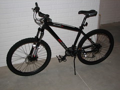
New Bike Arrives
Since I made a post about this bike coming soon, I procrastinated on actually ordering it until earlier this week. After finally ordering, it came very quickly, showing up at my door today. It took me about an hour to assemble, and appears to be a very high quality machine.
I'm looking forward to getting it out on the trails. I still need to buy a hitch-mount bike rack, and I need to replace the rear skewer on the bike in order to use it on my trainer. Replacing the skewer will be a challenge because of the delicacy of the rear cassette.
I'm looking forward to getting it out on the trails. I still need to buy a hitch-mount bike rack, and I need to replace the rear skewer on the bike in order to use it on my trainer. Replacing the skewer will be a challenge because of the delicacy of the rear cassette.
Severe Wx Expected Here Tomorrow
The Thursday outbreak did not pan out, barely meeting slight risk criteria. There are strong storms from Iowa to Tennessee, and there have been a few tornado reports, but it's nothing like was feared earlier this week.
Worse weather could actually come to our area tomorrow. The Storm Prediction Center has outlined the Toledo area in what's called a hatched area, meaning there's a chance here for significant severe weather including possible strong tornadoes. I'm not sure yet of the timing of this event, but the wind profiles will definitely support severe weather (rotation especially), and if proper instability presents itself, things will go. Hopefully it bypasses our immediate area.
Worse weather could actually come to our area tomorrow. The Storm Prediction Center has outlined the Toledo area in what's called a hatched area, meaning there's a chance here for significant severe weather including possible strong tornadoes. I'm not sure yet of the timing of this event, but the wind profiles will definitely support severe weather (rotation especially), and if proper instability presents itself, things will go. Hopefully it bypasses our immediate area.
Subscribe to:
Comments (Atom)